Driving into Namibia feels like stepping into another rhythm. The chaos of the border roads gives way to long, straight stretches that run through quiet farming towns, river valleys and open desert. From the green Zambezi Strip to the cold Atlantic coast of Swakopmund, and down to the wind-swept rocks of Lüderitz and the ghost town of Kolmanskop, each stop shows a different contrast of beautiful Namibia.
There is only so much preparation one can make. At a certain point, there is a need to accept the inevitability of surprises, of things not going as planned. In hindsight, that is an easy attitude to take; instead, our car was packed full, we had multiple photocopies of all the necessary documents, and our prized possession, Map Studio’s Southern Africa Roadmap, 7th Edition, was folded neatly on the dashboard. Sarah, Chief Navigation Officer (CNO), and I were driving from Lusaka to Stanford, a town near Cape Town. Via Namibia.
We left Lusaka early. It became a ritual that would define the coming week. Sarah had never been to Livingstone, and it had been a long time since I had seen ‘The Falls’. The road was smoother than I remembered. But then again, roads in Zambia; is anyone quite sure what to expect? Tales of broad new avenues merge with horror stories of deranged truck drivers and suicidal goats pottering on the road verge. In truth, the road wasn’t so bad. Traffic owes itself to the farming towns that stumble upon one another, a deformed spine down to the border.
The rains were late, and Livingstone seemed to be paying the price for it. The sun was unforgiving as we arrived in the early afternoon. But the town bustled, despite the heat, or perhaps because of it.
I had heard how sorry the Victoria Falls were, but words pale in comparison to the unforgiving nature of sight. The Victoria Falls is still an impressive sight, its sculpted form more visible in the absence of water. But few visit to study the rocky outline of its basalt cliff. They wish to be awed by its power, to feel the thrill as thundering water rushes to a new life below. We felt increasingly hot in the unmediated sun.
We had been told that the road to the Sesheke border post with Namibia got bad at some point. But the next morning, after a greasy breakfast, we found out just how deceitful it was. Until the turnoff to Kazungula, the road was smooth, but soon afterwards, it began to fracture. Within minutes, we were travelling on a road that shifted surprisingly elegantly between a dirt road resembling corrugated roof sheeting and bits of tar. I hated it, and so did my car. We often came across trucks heading to and from the border, reminding me that this road did actually go somewhere. The trip should have taken us less than forty-five minutes; it ended up taking us about three hours.
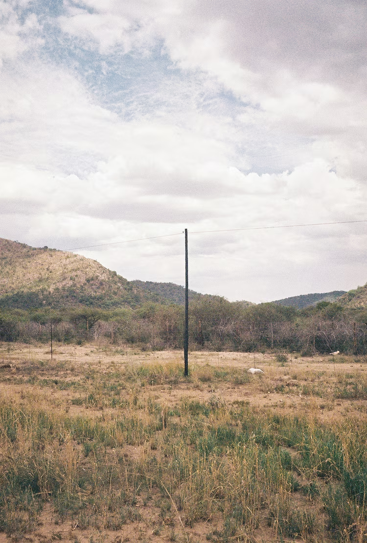
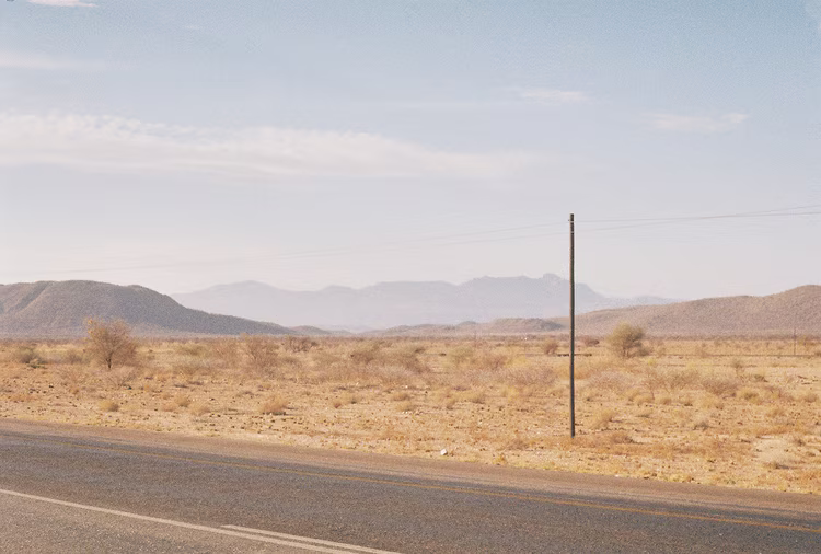
We crossed through the border post relatively easily. Sesheke is a modern cowboy border town, reminiscent of a setting in a Kafkaesque novel. Cows wander among trucks parked off to the side, whose drivers are off visiting roadside bars or picking up spare parts, waiting for their turn as some overworked government official processes their papers. In contrast to Zambia, the roads in Namibia show little sign of wear and no tear. There are working signposts. Even the fences seem more orderly. And there is less traffic. Or rather, there is less chaos.
That afternoon, we drove on a road that veered little from a straight path. Its precision was unnerving, an exactitude seldom found elsewhere. The Zambezi Strip is itself a geographic anomaly, the creation of a ruler and pen wielded by an enterprising imperialist. So we headed dead west on a tourist route known as the ‘Four Rivers Trail’. An abundance of water defines this region, and the air is electric with thunderstorms on the horizon.
We passed through a mix of farmlands, farming towns, and national parks, interspersed in no particular order. Sable skirted close to the road. Late in the evening, we arrived at our lodge, which overlooked the Kavango River. The river marks the border between Namibia and Angola. It was dark, but the slow-moving river still reflected the setting glow of the orange sun. That night, we had oryx steak whilst listening to the water lapping gently against fishing boats moored near the decking.
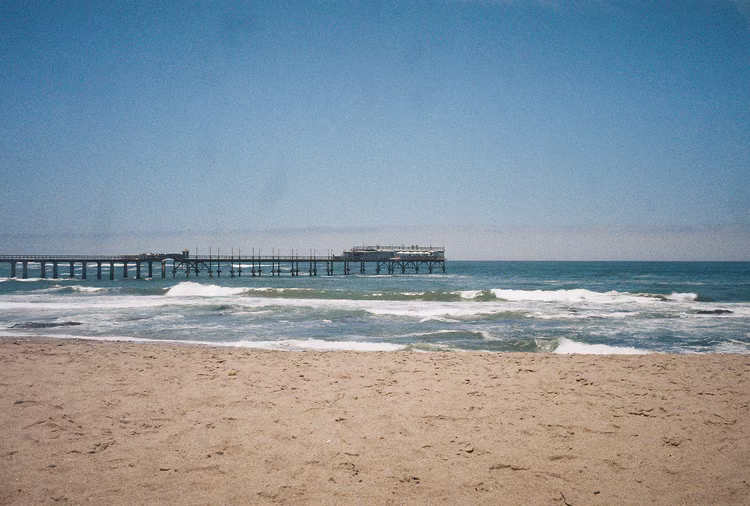
The next day, our destination was Swakopmund, a town at the mouth of the Swakop River. That would mean driving around 1,100 km in a day, notwithstanding the car’s thermometer, which flirted with the 40°C mark. It was the middle of a particularly hot summer.
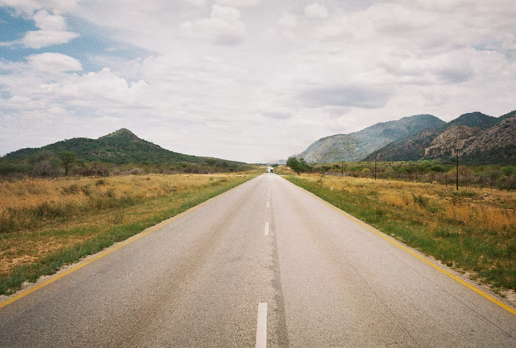
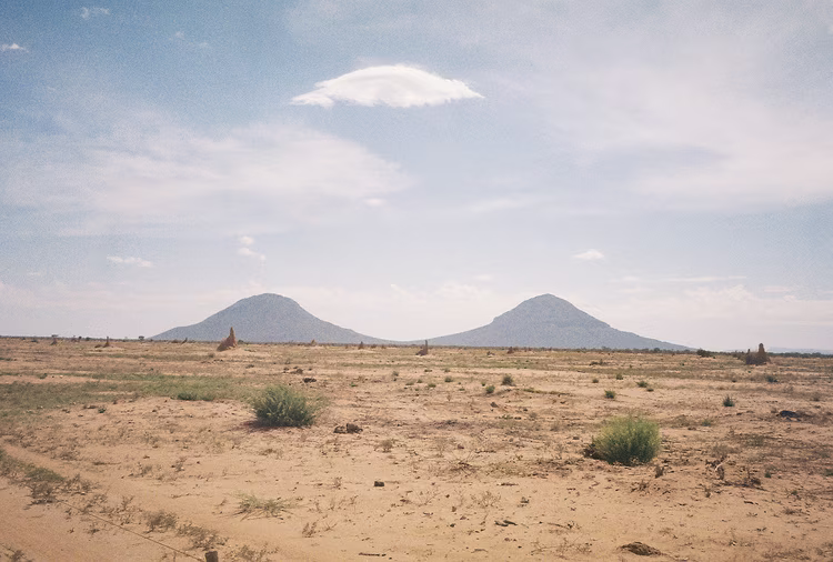
We headed southwest, from Central Africa’s tropical hinterlands to the desert coast. The roads are unwavering in their dedication to geometry. The monotony of the road allowed us to notice the subtle changes in the landscape more carefully. Fewer villages hugged the road, and town names began to lose their Bantu roots, replaced by those of Afrikaans and German origin. The dark green of tropical Africa gave way to vegetation that by degrees grew sparser until there was almost nothing at all, only tufts of hardy grass eking out an existence between rocks and sand.
We arrived in Swakopmund late at night, around 9 p.m., which made it a 14-hour drive, give or take. A cold mist enveloped the town, so different from the dulling heat of the interior. We were staying in a self-described ‘alternative’ bed and breakfast, run by an older couple. They were kind, gentle souls with the unmistakable air of former hippies.
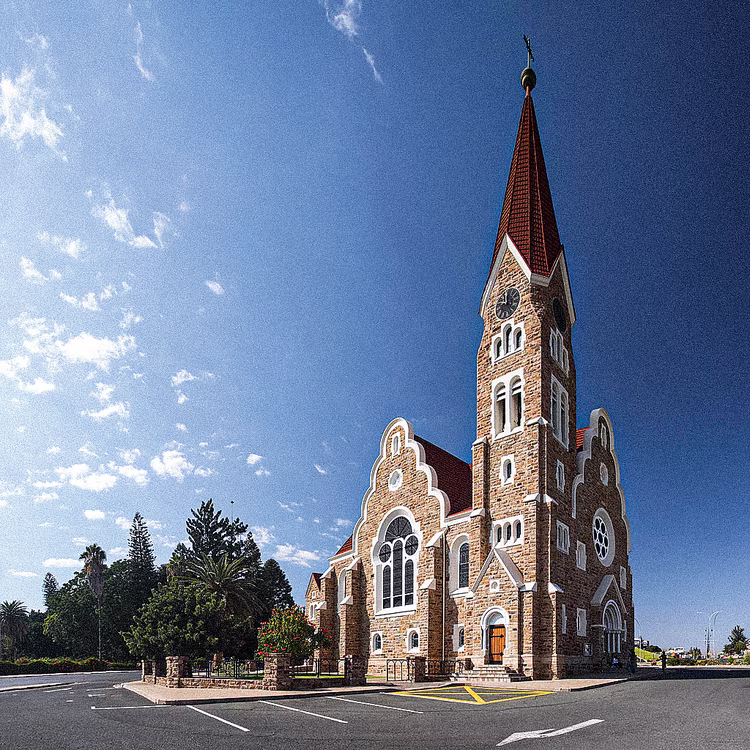
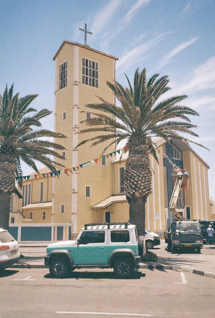
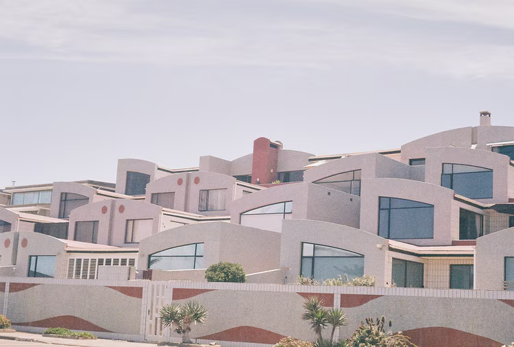
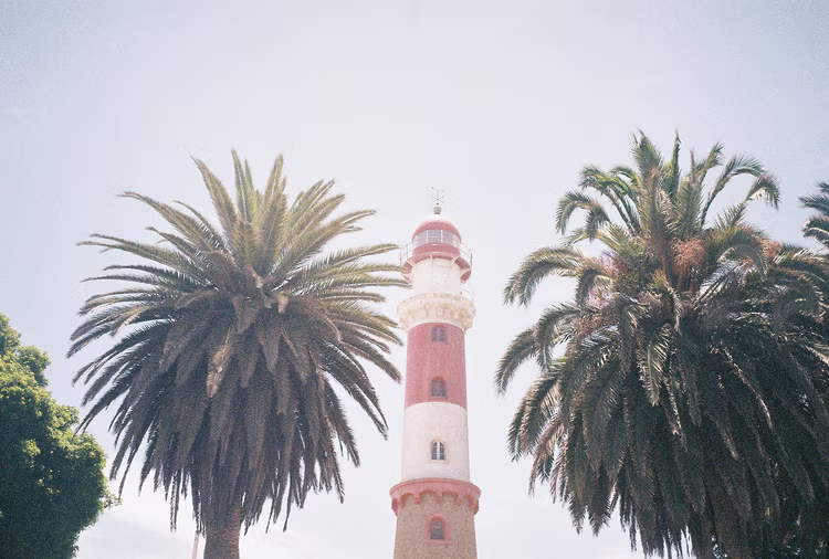
The following day, we went around the town like a couple of holidaymakers. Swakopmund is a holiday town that holds its German heritage dear. It articulates itself in the architecture, the European-style cafés with German pastries, and the shopkeepers who speak a clearer German than a Berliner. Like all enclaves of a foreign culture, the inhabitants hold firm to their heritage, as if in defence against the desert surrounding them, and perhaps the winds of political change. But the town is born from a marriage of the river, ocean, and desert, and there is only so much change that can be resisted. We spent the day visiting the quaint shops and walking by the seafront.
We left early the next morning for Lüderitz, another port town in the middle of the desert, but far more remote. As the crow flies, Lüderitz is only a few hundred kilometres down the coast from Swakopmund. But the Namib Desert separates them. We decided to take the long way around, heading back to the primary highway that runs through the middle of the country like an artery. We passed through Windhoek, which, from the roadside, seemed underwhelming but came alive with commuters in the afternoon haze.
The journey south took us through oasis towns. Nothing else explains their existence, apart from a few surrounding farms. The absence of things grew dire, forcing us to contemplate emptiness. It grew more pronounced as we turned off to Lüderitz. We passed by Fort Naiams, an old German fortress used during their conquest of Namibia. It now stands as a ruined relic, underscoring the essential hollowness of colonial expansion. Soon, the reddish hard rocks gave way to sand.
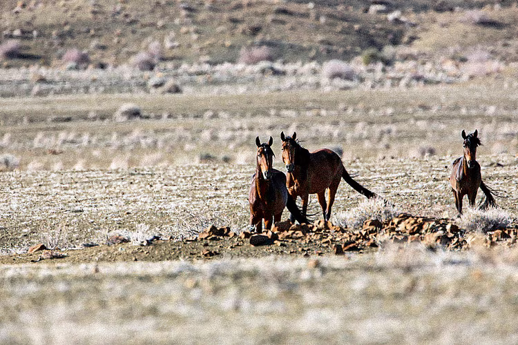
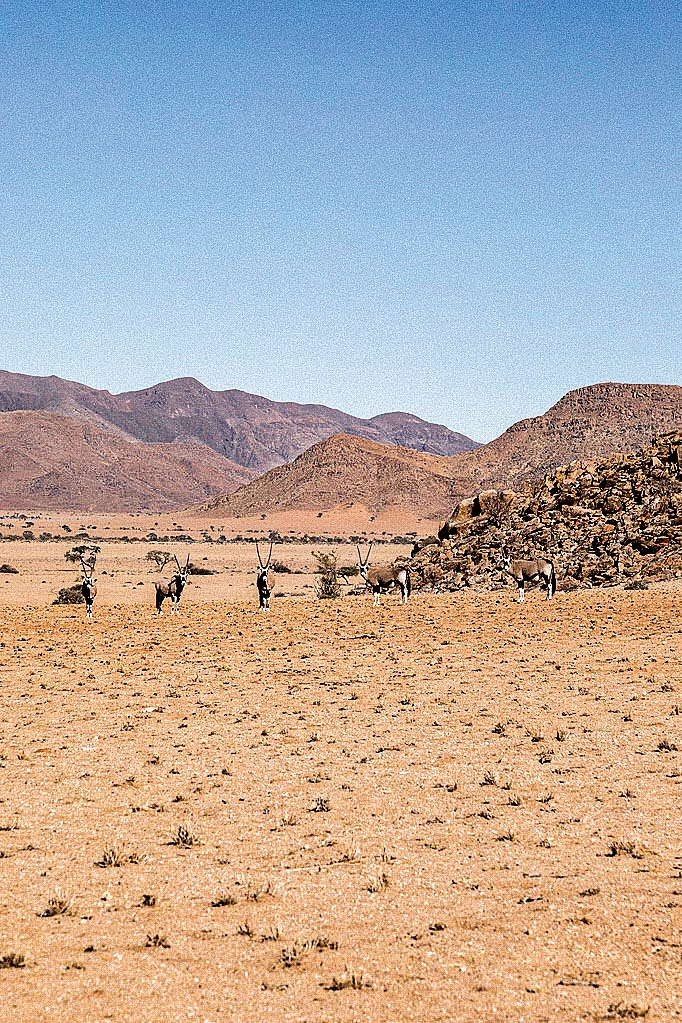
During dusk, the sun was big, bigger than it should be. Bigger than I had seen it for a while. Shards of sand hung in the air, mixing with the dying embers of sunlight as they cast a last look upon the empty landscape. Only oryx and wild horses could be seen, their silhouettes merging with the darkness quickly following the sun. We neared Lüderitz in full darkness, sand encroaching onto the road and shaking my car as my vision began to wane.
We got to Lüderitz at nine in the evening. The gate of our backpackers' lodge was closed, delaying our collapse onto the bed. We rang the bell a few times, but no one answered. After ten minutes of repetition, we decided to find a place to have dinner. We found a restaurant with a fishing net outside, ate seafood, and used their telephone to call the backpackers. No response. We spent the better part of the following hour driving around the town in search of accommodation. Everyone was either fully booked or closed.
We found a quiet place to spend the night in the car. The wind was howling, apparently a constant occurrence around this time of year, making it seem at times that someone was knocking on the windows. Cold air crept through the doors. I managed to sleep well, but Sarah was not so lucky.
The foggy morning revealed a medium-sized fishing town, houses cut out of the rocks, and a view of the harbour. It shares the same quaint German architecture as Swakopmund, although it felt less touristy, more a part of the everyday life of the townsfolk. We found a café to have some morning coffee. Adverts for extreme sports and tours to the ghost town of Kolmanskop lined the walls. We slowly sipped our coffee before we found the courage to venture back to the backpackers. We attempted to force them into a position of guilt, but they showed little care that we had spent the night in the car. I think I managed only a single apology from the receptionist.
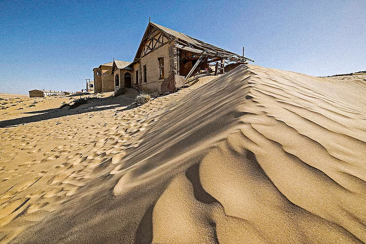
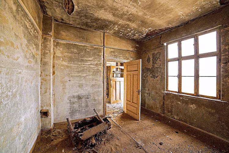
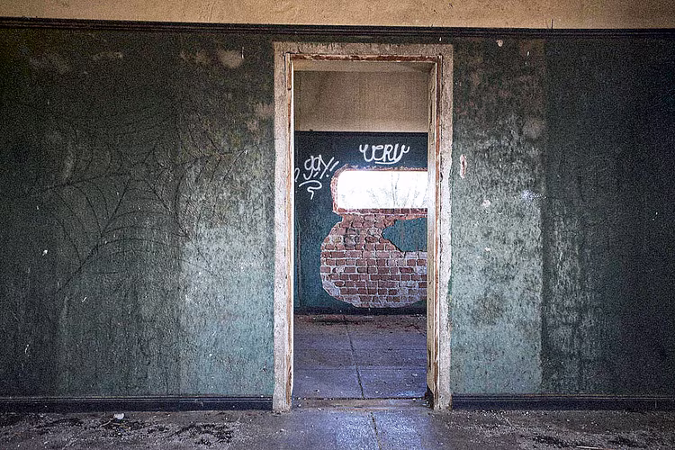
Lüderitz is the product of a mining boom. During the early 20th century, diamonds were discovered in the nearby town of Kolmanskop, along with other deposits in the area. It is now the primary tourist attraction of this isolated port town. Tours were happening in German and English, but we didn’t join; instead, we took our time walking through the eerie landscape. At the time of its boom, it was replete with amenities, housing everything from a hospital to a theatre. Now all has been consumed by the desert. As soon as it boomed, it began to die; other diamond fields were found elsewhere. Such is the nature of boom towns.
We reached the Namibian–South African border post around mid-morning the next day, after winding along the Orange River. At the border post, there was barely a soul in sight, which made clearing the border easy. Entering South Africa didn’t change the landscape, nor did it ostensibly change the people who inhabit it. The reddish, rocky earth extended to the hills on the horizon. There were more cars and more towns, but they were still subjects of an unkind land. The most memorable was Springbok town, mainly because of a drunken fight at a petrol station. The sun was as unforgiving as in Namibia.
The change in landscape happened more dramatically than in Namibia. After skirting the Karoo and passing over the Cederberg Mountains, farms bearing fruit and vineyards came into view. The temperature cooled, and the rivers were no longer dry. We stopped at Piketberg in the afternoon. We were at least five hours away from Stanford and had already been on the road for twelve hours, but we decided to carry on for one last stretch. We careered through the mountains separating the coast from the hinterland that evening, climbing and descending seemingly simultaneously, before we noticed the strained lights of Stanford in the distance. It was 10 p.m., marking the end of a 17-hour road trip. The headlights cut through the last stretch of the rolling hills, the journey folding into its quiet end. We had made it, via Namibia.